IMAGES & IDEAS


As a young boy growing up in Glasgow several images and ideas of the city burned themselves indelibly into the back of my brain. One of these was the image of the small conifer plantation (the forest at the end of the world) which could be seen as a tuft of trees from atop the railway bridge at Scotstounhill (looking north up Lincoln Avenue through Knightswood and beyond). I had always been curious to actually find it, be in it, and not just see it from afar. It was only some thirty years later that I finally got round to doing so, when I started roaming the Kilpatricks and Campsies. The 'forest' is called Carneddens Wood and is located on the far eastern edge of the Kilpatrick Hills on Douglas Muir (in the left of the picture here).


Having grown up on the fringes of Knightswood (the old stomping ground of the Knights Templar who used to hunt here when it was all forest), I was privy for some three decades to the passage of the 44 bus whose northern terminus lay in High Knightswood. Yet, living as I did on the fringes of Kightswood it was the southern terminus whose name I had been brainwashed with, for this was the bus I would take to go into the city, the 44 to Eaglesham via Langside. I yearned to place this terminus, to see this mythical land with a name which had already conjured up the image of skyclad eagles cavorting with large hocks of ham.

This hill pictured here is one of several aside the 44 terminus. It is called Dunwan and sits quietly above a small loch at the back of the placid village of Eaglesham. From its brow, looking north, one can see the whole of the city in the distance, and, if you managed to remember your binoculars, you can easily see Knightswood, its hills and towers. Looking in the opposite direction you can see out into the Atlantic. And, if you're really lucky you may even see an eagle or two.


IN PRAISE OF PLUGS


Dumgoyne - Dunblane - Dumbarton


As the son of an electrical engineer, I've done my fair share of crawling under floorboards and wiring up plugs. These plugs here, however, give a whole new meaning to being 'earthed'. These are only three of the many stratovolcanic 'necks' that exist within the Greater Glasgow area. But they are some three! These rocks and landforms are the physical reminders of Scotland's growth as a country at its most fundamental level. This grounding reveals Scotland's passage not just through time but across the very surface of the planet itself. The land that makes up Scotland has travelled the world and has not always belonged to one single continental landmass. It is, primally, this fiery mobile 'Scottishness' that pulses though my own body/brain and convinces me more and more to wander/wonder. Incidentally, the prefix 'dun' or 'dum', if you haven't guessed already, simply means 'hill' in the Gaelic tongue.


THE ANTONINE WALL

Happy the man who far from business ploughs again his ancestral lands.
Horace ‘Epodes’


Up here, along the old Roman way, from Bo’ness (Borrowstoneness or Bridgeness) on the Firth of Forth to Old Kilpatrick and Bishopton on the Firth of Clyde, the 17 extant forts of Antoninus Pius’ rampart string a 40km hilly cincture from east to west, across Scotland's narrowest point. The Antonine 'Wall', actually a wide deep ditch with an earthen rampart behind it), was accompanied along its length by a metalled road known as The Military Way. This was all abandoned by the Romans after only 20 years but many sections have remained visible until the present day. Even where the rampart has been flattened the silted up ditch still survives. The following pictures represent just a few of the forts and extant grounds within arm's reach of Glasgow.


On the way to Falkirk, Seabegs Wood still boasts the earthen rampart as seen here, and some wonderful trees. At the top where a fortlet used to stand there is another exceptional view of the Kilsyth Hills and the Campsies.


Looking west across the Kelvin Valley towards the gentle hump of Craigmaddie Muir with the Campsies to the right and the Kilptaricks eking out behind on the left. The Firth & Forth Canal and the town of Twechar are down towards the immediate left, out of picture.


Despite many thinking that Old Kilpatrick (on the north side of the river) is the western terminus of the Antonine Wall it is actually here aside Ingliston Stud Farm in Bishopton. Nothing remains of the Roman fort except the view and the hill. Here we are on a cool blue day in September looking north to the volanic plug of Dumbarton Rock, and behind to the Sphinx-like silhouette of Ben Lomond at the beginning of Highland range.


From above Old Kilpatrick on the Kilpatrick Braes looking east along the ophidian River Clyde. Opposite Bishopton on the other side of the river we are inter-castri so to speak, standing between Old Kilpatrick (Ferrydyke) and Duntocher. Both of these Roman camps contained forts with Duntocher benefitting from the addition of a fortlet too.


Not far from here was the Roman fort at Duntocher (near the top of Peel Glen Road) as well as a large camp nearby in what is now Bearsden. This picture looks south from Cochno Hill in the Kilpatrick Hills to 'where vast Tintoc heaves his bulk on high, his shoulders bearing clouds his head the sky' as Hugh Mcdonald says in Rambles Round Glasgow in the 1850s. Tinto Hill, at the start of the Scottish Lowlands, is that almost pyramidal shape beyond the city in the left centre background. This picture from the Kilpatricks (effectively the foothills of the Highlands) perfectly captures the midland valley basin that Glasgow lies in before the land rises once again into the Scottish Lowlands.

KEEPS AND KIRKS, AND A HUNTING LODGE

The Glasgow and the Clyde Valley area is awash with castles and churches. Some of these dating from as far back as the 12th century are nothing more than a cobbled collection of stones; most have disappeared altogether. There remains however a valiant few who stand testament to the region's colourful and parochial past. Some of these are below:


Stanely Castle stands inaccessible in Stanely Reservoir just behind Paisley on the way to Glennifer Braes. The castle (another L-plan tower house) is constructed in local freestone, which shows very little sign of weathering, though plenty sign of moss and grass. For relevant information on this and other castles/keeps check out Gordon Mason's excellent guide The Castles of Glasgow and the Clyde, one of the many terrific books on the city available at Glasgow District Libraries.


The extant ruins of Gilbertfield Castle in Gilbertfield farm in Cambuslang (just roll on in and say hello to the farmer, he won't mind). It lies on the slope of Dechmont Hill, itself a fine observatory of the surrounding land, and best got at through another farm. The castle is an L-plan tower house and was built, according to a heraldic panel above the front door, in 1607. The castle is within the former barony of Drumsagard, which was a possession of the Hamiltons.


Another castle en route to the hills, (there are just too many to document here, they deserve a whole blog unto themselves). Bardowie Castle, now a private home, is on the way to Milngavie, and sits on the edge of Bardowie Loch. The estate was originally owned by the Galbraith chieftain's family in the 13th century, but passed by marriage to the Hamiltons of Cadzow in the 14th century. The castle, rectangular in plan-form, was originally built in 1566, with additions made in the 17th and 18th centuries. In 1707, the sister of John Hamilton of Bardowie married Gregor "Black Knee" MacGregor, chieftain of the clan at that time and Rob Roy's nephew.The castle later passed to the Buchanan family and was owned by a Buchanan until the latter part of the 20th century. Modernised in the early 1990s it was sold for around £1 million in 2004. The advertisement described '6 reception rooms, 9 bedrooms, 8 bath/shower rooms, kitchen, library, home cinema, 2 kitchenettes, sauna, gymnasium'.


Neilston Parish Church.


East Mains Castle Keep in East Kilbride.


The magnificent Paisley Abbey.


Mugdock Country Park boasts a few castles of which this one is by far the best preserved.


Cadder Church and Graveyard lies just off the Forth and Clyde Canal about 7km north of Glasgow between Bishopbriggs and Kirkintilloch. It forms part of the cincture that was the Antonine Wall although nothing remains of the fort that was stationed here. The church itself designed by David Hamilton (1768-1843), one of the contributors to 19th century Glasgow, was built on the grounds of the old church in 1825. If you're feeling particularly morbid there's a memento mori in the graveyard of an open steel coffin. Unfortunately though, for those vampiric enough to try it for size, there doesn't appear to be a lid.


Baldernock Parish Church was built on the foundations of a previous church in 1795. The earliest decipherable headstone dates back to 1665 though there are others whose faces have been swept clean which date back slightly earlier. Closeby are the rhizomatic ruins of Craigmaddie Castle which are accessible through one of the area's many farmsteads. Indeed, this whole 'parish' is full of quaint little curiosities and is a fine starting point for an interesting afternoon's wander. Just to the north are the Campsie Fells and to the west the Kelvin Valley.


The name of Chatelherault is derived from the French town of Chatellerault, the title Duc de Chatellerault being held by the Duke of Hamilton. The country park is centred on the former hunting lodge of the now demolished Hamilton Palace. The lodge was designed by William Adam, and completed in 1734.


There was an original castle on this site near the village of Drymen as the seat of the Buchanans. But in 1682, because of financial difficulties, it was sold to the Graham Marquis (later Dukes) of Montrose. This building was burned down in 1850 and the present building was created, designed by William Burn with gardens modelled by "Capability" Brown.

After the death of the 5th Duke of Montrose, Buchanan Castle was sold in 1925. It was used as a hotel and then a military hospital during the Second World War. Hitler's deputy, Rudolph Hess was treated for injuries there after he crash-landed in Scotland, near Eaglesham, in May 1941. In the 1950s, in order to avoid paying local taxes, the roof was removed and as a result the building deteriorated rapidly. Much of the surrounding land became a golf course and a number of houses have also been built in the grounds.

In 2003, a planning application was turned down to demolish the internal walls of Buchanan Castle and retain only the south and east walls. 39 flats would then have been built in the interior space of the ruin. However, it is likely that the developers will be back with alternative proposals.


The magnificent rubescent Bothwell Castle donjon.


The 15th century Duntreath Castle Keep in the shadow of the Campsies remains relativey untouched since its inception. It can be reached either from the A809 or from the West Highland Way round the back of Dumgoyach plug.


Crookston Hill near Cardonald and the 14th century castle atop it present us with an ideal opportunity for all round vistas. The terrace at the top is beyond words in its capacity to show Glasgow from another aspect. The castle itself was the one time home of Robert de Croc and is set in its own grounds. Glasgow is a city of castles with some dozen or so in excellent condition in the city itself. On its fringes there are many more, and whether you like castles or not, if you can get up to the top of them, they are outlook towers of the first order.


IN THE MAMMARIES OF THE CAMPSIES


In the Mammaries of the Campsies,

The cleavage of the world -
The wanderer wandering
above the mist


On the way down from Earl's Seat, the highest point in the Campsies, the two paps in question are Slackdhu (on the left) and Dumgoyne (on the right).


The Skull of Dumgoyne


Elemental

The forested ridges, the blossoming pears, the shifting clouds -
Who is it all for? Li Po

With a bit of madness in me,

which is poetry,

I hover above like a kestrel

among the wails of the wind.


TOR

Are we all just primitive beings whose towers have been destroyed? Gerard de Nerval


If you asked a Spaniard I believe they would call you torero
the bullfighter on foot -
An ancient Celt might have you, Jonah-like, residing in the belly of the world -
On the other side of the planet the superbly silent Shinto Masters have him as the perched bird torii
And, in the old Germanic tongues, I have even heard him called the fool - the one who walks the hills -

Nevertheless, it is none of these
Not now
not here
Acropetal
rising to the top
with a restless unthinking
Numb - inert - still
the very view going on forever
From the crag of all creation -

Tor


The Diamond Treasury


In the east I have scaled the mountain they call Huang Shan
where Taoist hermits sought the immortal -
I have ascended the teeth of the diamond mountains of North Korea, the land of 12000 miracles. 12000 pinnacles.
At Mount Kailas I have entered the pagoda palace of Demchog, the One of Supreme Bliss -
and beneath Tongariro with blinded Maori warriors I have averted my eyes from the fiery goddess that inhabits its peaks.

In the west, I have been painted by the Zuni of North America and sent into the mountains to be born -
In a temple far finer than those made by human hands, I have listened to the stone sermons of the Sierra Nevadas, and
On the sacred mount of the Navajo I have been fastened to the earth with a single solitary sunbeam.

In southern Anatolia I have walked the ledges of Olimpos and breathed fire with Bellepheron -
In the Kingdom of Morocco, supervised by Titans, I have mapped a new world midst the Atlas -
Of the Alpine Engaden, I have gone mad with the lightning sharp clarity of snow-capped peaks -
And of the Scottish High Lands I have vanished from all trace and become nothing -

Midst the mountains of this world and the next, I have been to the place they call nowhere.


Ascent of Ben Lomond, April 4th 2006


Blind Spot

seeing something from another perspective
might involve

not seeing it at all
the parallax of absence
countering its presence

seeing it
from such a spot
that it ceases to become visible
and where the seeing

of the not there
is another angle

an angle neither obtuse
nor acute

the angle of zero degrees


Contrail

I can only imagine what
it must be like to be a
contrail
little crystal water droplets
sealed in the blue air
shimmering, slowly shape shifting
finally fading into nothing
the signature of the sky slowly
becoming nameless


Tachyon

Tender little particle
Rhythm of being
Though we know it not

This capacity


Tozal

this is the Zenith the way
of the white clouds
the path
of the mindless mind

up here
on top
of it all

on the tozal

total


The Mind Aligned

Here.
Now.
Pushing ahead
flowing locomotive
the mind flowers
attaining stillness
and finds
in momentum
the moment.


The Southern City Trimontium

A triumph of hills

these emperors of green

Melowther

Dunwan

Ballageich


LOCH ACROPOLIS


Greenside Reservoir and the ridged Slacks (whose summit features as the title picture to this blog)


These lochs up here

Cochno
Humphrey
Fyn
Lily
Black

Mere puddles to mountains
Shiver with the wind on their skin


(Top) Looking east from Duncolm.

(Above) Cochno Loch and Jaw Reservoir in the Kilpatricks with the Birnie Hills and their conifer plantations in the background.


Loch Humphrey


Greenside Reservoir in the Kilpatrick Hills


Above Greenside Reservoir

shadowy migrations across the surface

a crackle of crows in the distance

one lone black-headed gull

circling -


In the Kilpatrick hills, looking west to Greenside Reservoir and the Slacks (from the Gaelic 'slocs' meaning saddles or ridges) from Cochno Hill.


ACRO-NECROPOLIS

There are many advantages to be had from a hilly city none more so than the mental strength it conveys through its infusion of a subtle mathematics. There is poetry to these curves. Curves which fall into that ground between order and chaos and which mathematicians refer to as complexity. Total order and total chaos are equally uninteresting for their perfection and predictability. With the curves of an uneven floor we have the beauty of an equation still in progress. Nowhere are these gentle slopes and tender curves more prevalent than in Glasgow’s Central Necropolis, one of the city’s great green spaces. Its sweeping tree-lined bends and soft ophidian slopes are tended with care ensuring that the dead are better kept than some of the living. This is to say nothing of the magnificence of mausolea that decorate the necropolis. With the cemetery’s acropolitan aspect (to the south and east of Glasgow) and the ensuing aeriation one receives from this, the dead are as much inspired as they are expired.

Further up the road is another cemetery with views, the aptly named Sighthill, though it is a shame perhaps that much of this view is blocked by unsightly high-rises.


BARSCUBE HILL


At 258 feet off the ground Barscube Hill could hardly be called a mountain, but it does offer undeniably stupendous views all round. Here, more or less above Langbank, we are looking west to the bumpy outline of the Cowall Peninsula.


Looking north across the Firth of Clyde to Dumbarton Rock, the town of Dumbarton (the hill of the Britons), the tributary River Leven, and Ben Lomond (the beacon hill) in the distance.


Still on Barscube Hill (can you blame me? Just look at that light!) we look east to the city in the distance, with the Kilpatricks of course now opposite on the other side of the Clyde. The southern aspect looks onto the Kilmacolm Hills, Queenside Muir and the Tolkienesque sounding Misty Law.


SOME THOUGHT FROM THE TOPS


Hills are complex yet subtle - from afar they look just like bumps in the otherwise flat land; it’s only close up, supernatural, once you’ve struggled with it for a while that you realise its complexity and sophistication.


Hills as perches and outlook towers are unrivalled in their capacity to offer sight to the blind, to offer the evidence of a bigger picture to the skeptic.


It is a curious coincidence that the word perch when consulted in a dictionary is found to lie between two words which appear inextricably connected to its intrinsic nature. The preceder is the word ‘perceptual’ (relating to the ability to interpret something through the senses); the sequitur is the word ‘perchance’ (by some chance).


Flowers on the hillside flow. This is why they are called ‘flowers’.


As mammals with an outer porous membrane it is conceivable to think that when upon the hill, open to the elements, and in the midst of all this space and light, the world flows right through us.


As heliotropic entities (especially we hyperboreans) it is perhaps understandable how a proximity to the sun, and the only star in our solar system, can induce a state of bliss and unfettered jouissance.


Hills contain, at every point of their scaling, secrets.


The hill, as a once powerful volcano, represents a sleeping earth giant who once, in ancient times, broke through the integument of earth in order to be reunited with the sky.


At its summit, the hill, like sunlight, surrounds you, and yet offers you illumined freedom.


Atop a hill, even on a cloud ridden day, I still feel the sun.


On a clear day from even the most modest hill the curvature of the earth at once imperceptible suddenly becomes clear. We do not have to go sub-orbital to appreciate the blue and green planet.


Schiehallion, as the sacred Celtic mountain, makes itself known on each and every summit.


At the top of the hill we are naked - temporarily stripped of our conceptual cloth. With the doors of perception cleansed, the infinite makes its case. From the top of the hill, the void becomes visible in its vast open space.


Everyone needs an elemental thrashing once in a while and the top of a hill is the ideal place for it.


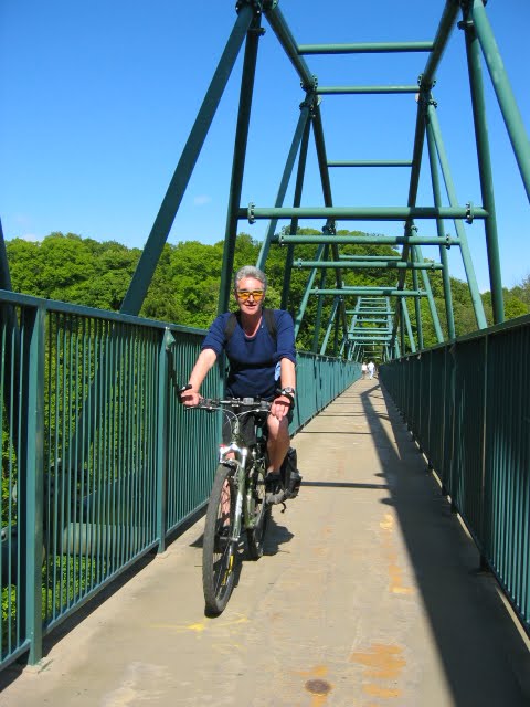
One doesn’t need to go to extremes with a hill. It is open to all. This flexibility is a hill’s greatest asset.


The hill, like peace, is silent. The mountain, like pain, is dumb.


The quality of a hill is not measured by its height but by its view, and gift of the void (the absence of blockages) which it holds from its top. Hills needn’t be ‘high’ to offer a panorama of the surrounding landscape. Indeed, depending on the topography of the outlying land a hill need only be a few feet from the ground to enable an alternative sighting of the environment.


From up here, halfway up the sky, there is a fluency to the aerial imagination, a sense of wonder in which all things are perpetually fresh.


In the high blue depth, surrounded by the elements, heated by the sun, there is the reverent sense of being within that which has not yet come.


There are many advantages to be had from a hilly city none more so than the mental strength it conveys through its infusion of a subtle mathematics. There is poetry to these curves. Curves which fall into that ground between order and chaos and which mathematicians refer to as complexity. Total order and total chaos are equally uninteresting for their perfection and predictability. With the curves of an uneven floor we have the beauty of an equation still in progress.


The flat city, on the contrary, being able to see straight ahead and with everything in full view, benights the imagination and leaves nothing to chance. Flatness is a demon that rages long and wide, bringing with it a terrible topography.


At the top of the hill embrace your solitude. Make it work for you! When the universe recognises you, remind yourself that you are, in spite of your solitary nature, accompanied every step of the way.


Up here, I am no slave, but the earth, it owns me.


A hill with its trickling streams and fresh air is nearly always the perfect place for a distillery, or a temple, or mind.


From the heights, the bens, the fells and braes, the peripheral kingdom of Glasgow’s earthly skirting board, the city with its high rise concrete pillars when it doesn’t resemble a cancerous spread, resembles a graveyard with its grey pitched tombstones.


The materialised man sticks fast in the mud of his consumption; whilst the dematerialised float off, hypaethral, into the hills.


Clouds are the stars of the days, vagrant and evanescent constellations.


On high, the wind teaches you to talk, the heights teach you to listen.


On the Hill height bears a direct relationship to depth. Indeed, the mind in many ways resembles a sort of inverted depth charge, whereby the higher it goes the more likely it is to go off.


There is something primal (umbilical) about engaging a hill and reaching its zenith, the apogee of that point furthest away from the earth (population) - and the point at which you have seemingly left behind a plague of people. Walking up a hill I often have the strange Orpheic feeling of having left behind a tenebrous cacophonous underworld in which perpetually moving machines grind.

SOME STRUCTURES ALONG THE WAY


'Humans have to pay'

The Yoker-Renfrew Ferry, and swans.

The hat has to come off for the Yoker-Renfrew Ferry which in one shape or form has been plying its trade for half a millenium. Without this balletic beauty many of my excursions to the southern hills would have lost much of their initial oomph. Pirouetting across the Clyde (it's barely a one minute crossing across 50-200m depending on the water level) you can see the Kilpatricks in all their glory mid-stream. There are actually two ferries that alternate: The Renfrew Rose and The Yoker Swan, so called after the two neighbourhoods on either side of the river, and after the family of swans that reside here. Sadly, there was talk of Strathclyde Passenger Transport dismantling the service but it looks like (after totting up their sums) they're going to keep it.


The Glasgow Science Tower, looking rather like a huge syringe.


The Falkirk Wheel (or at least the top of it) and the Ochil Hills behind. The Falkirk Wheel solves the problem of joining two canals and reconciling a height difference of some 24m between the Union Canal and the Forth and Clyde Canal. It is a masterpiece of engineering and the views ain't too bad either. The Roman fort of Rough Castle, part of the Antonine Wall, is located nearby.


The Art Deco facade of the India of Inchinnan building designed by Thomas Wallis in 1930. It lies on the Old Greenock Road just over the Black Cart Water and the wonderful Inchinnan Bridge.


On the way to Lochwinnoch, Kenmuir Temple, built in 1727, was initially and observation tower for keeping tabs on the white deer. It offers fantastic views over the village of Howwood and Castle Semple Loch. This was taken from the Sustrans (sustainable transport) cycle path. They have done a wonderful job all around Glasgow and UK refashioning old dismantled railways into pathways. Without these paths, the Zone would have limited appeal.


The George Buchanan obelisk in the lovely village of Killearn. Buchanan (later to become the Latin Professor and Prince of Poets of a youthful Michel de Montaigne) went to school here in the village and no doubt took a stravaig or two into the surrounding Campsies. He was packed off to Paris at the age of 14 by his uncle. His grave can be seen in Greyfriars Kirkyard in Edinburgh.


Over in Hamilton Low Parks stands the Hamilton Mausoleum built in 1858 for the 10th Duke of Hamilton. With the exception of the Pyramids and the Taj Mahal (and probably a few others) it is said to be the largest mausoleum in the world. The Hamilton Mausoleum is also reputed to possess the 'longest echo' (15 seconds) of any building in Europe. More interestingly perhaps, the edifice is now 15 feet lower than when it was built due to subsidence caused by coal mining. Much of the Hamilton family's wealth (of whom it has been said that their history is the history of Scotland) came from mining rights in the 19th century. The Hamilton Palace has already fallen foul of subsidence. It's only a matter of time before the mausoleum keels over too, if nothing is done to stabilise it. Andy Smith (bottom right) gives this magnificent structure a sense of dimension. It really is humungous!


Robert Tannahill's cottage in Paisley.


Bowling basin on the road to Dumbarton. This is where the Forth and Clyde Canal begins/finishes on its way to/from the Firth of Forth on the other side of Scotland. Behind you can clearly make out the rising stony Kilpatrick Braes. From Bowling heading east there is an old railway path which continues towards Dumbarton and its wonderful castle. From there heading north along the River Leven it's another 10km or so past Renton and Alexandria up to Balloch and the gateway to the Scottish Highlands, Loch Lomond.


The Livingstone iron suspension footbridge across the Clyde connects Bothwell with Blantyre, two peripheral towns renowned for their history. On the Blantyre side of the bridge is the former birthplace of the explorer David Livingstone which is now a museum, and on the Bothwell side, aside a few plush housing developments sits the red-bricked castle of Bothwell, begun in the 13th century by the ancestors of the Clan Murray. The area is positively steeped in history with Strathclyde country park just up the road boasting the excavated remains of Bothwellhaugh Roman Fort and bath-house as well as an arched Roman bridge.


This odd structure just past Bearsden lies on the Drymen Road opposite the ski-centre. With its modular interlocking concrete forms it reminds me of Moshe Safdie's 'Habitat '67' in Montreal. In fact, thanks to this structure's hilltop views across the city and the country, and its slightly less frenetic format, I would say this building (in spite of its austere grey facade) is less imposing and more gentle than Safdie's. Set against a february blue sky and with the rolling grassy knoll in front of it, its grey frontage actually seems appropriate. Whatever the case as to its aesthetic appeal, there's no denying this stony audience's capacity to provoke.


MARYHILL owes its existence to the building of the Forth and Clyde Canal in the late 17th century when it developed as a centre of heavy industry, including shipbuilding. This series of 5 locks down the hill was all part of the overall canal design by John Smeaton. Construction of the canal started in 1768 and after delays due to funding problems was completed in 1790.

Until the Forth and Clyde canal came along, there was very little thereabouts apart from the rural estates of several leading Glasgow families - and some light industry such as paper making along the River Kelvin. But the Kelvin was soon superseded by the canal, the triumph of the latter symbolised by the mighty Kelvin Aqueduct built from 1787-90 which carried the canal haughtily over the river on four heavy masonry arches. The Kelvin's water powered mills were also superseded by the clatter of steam engines as industries migrated to the banks of the new waterway.


'Cormorants on the Kelvin' - This, the central pillar of the former rail bridge here, is by far the favourite of the three remaining pillars for those cormorants. Today, it's a real gathering with eight of them drying off in the sporadic November sunshine.


The Kelvin Acqueduct with Gilsochill Estate in the background.


The Kelvin Aqueduct was a wonder of the world, the mightiest built possibly since Roman Times, and tourists flocked to see it, including crowned heads of Europe. It was the technical key to the Forth and Clyde Canal, itself the artery of the first phase of Scotland's Industrial Revolution. The engineer in charge of its construction was Robert Whitworth, and the cost of the structure, at £8500, almost bankrupted the company building the canal.

Scheduled as an Ancient Monument, were this structure in some rural retreat it would be visited by thousands; I doubt if more than a handful of the curious come to see it today.


A cautious grey heron and a cyclist on the towpath down towards the Erskine Bridge and Old Kilpatrick.


The Luma Lamp Building just off the M8 behind the Southern General Hospital. The former Luma Lamp Factory on Shieldhall Road is included in the Scottish Minister's List of Buildings of Special Architectural or Historic Interest as category 'B' listed. Its distinctive and principal feature is a tall conning tower situated at the south west corner rising to a height of 84 ft. The building was completed in 1938 to coincide with the Empire Exhibition sited in nearby Bellahouston Park (which contained the very wonderful 'Taits Tower'), and was the result of a joint effort of the Wholesale Societies of Scotland and Sweden, which in turn led to the formation of the British Luma Cooperative Lamp Company, as the Glasgow HQ of the first international cooperative factory for the manufacture of electric lamps..


There is a poetry to bridges that escapes most.

The Clyde Arc (aka. the squinty bridge) at dusk.


From Bishopton looking north at the Blantyre Obelisk and the Kilpatrick Braes in the background.